Monday, June 4, 2012

Astronomical Lightning Round

Hello and welcome back! There certainly has not been a shortage of weather headlines in recent weeks. Tornadoes, tropical storms, severe thunderstorms, wildfires have dominated the news and even prompted the word "biblical" to pop up. (I think that's a bit over the top, but I guess that's how you grab attention...anyway) While a lot has been going on here on Earth, space has been putting on shows of its own in rapid-fire succession! And we're not done yet! We've seen two eclipses in the last 3 weeks, and we're in for one more event, and this one is once in a lifetime! We'll get to that in a little bit...

Every year here on Earth, we are treated to four eclipse events, 2 lunar and 2 solar. Lunar eclipses occur when the Moon moves through Earth's shadow as it orbits the planet, while a solar eclipse occurs when the Moon moves between the Earth and the Sun. As you'd probably expect, lunar eclipses are much easier to view than solar eclipses since you need special eyewear to be able to look at the Sun. In fact, the Sun's light can be even more damaging to your eyes during a total solar eclipse, but that's a topic for another day!

It all started back on the evening of May 20 with the year's first eclipse event. Unfortunately due to the way things just happened to play out, we missed this event here in the eastern U.S., but folks in the west were treated to what is called an annular solar eclipse. So called because the Moon does not completely block out the Sun, but rather it leaves a ring of fire around its edges, as long as you are in the right location on Earth to see it. Luck will come our way eventually, but here's a little sampling of what we missed.


Jacob Thumberger in Gail, TX was in exactly the right place to catch the height of the eclipse.


Folks in Minnesota got lucky right as the sun was setting and caught at least a partial solar eclipse!
And here's a great timelapse of photos taken in California!

I would love to tell you that we'll get our chance during this year's second solar eclipse, but we will miss out on that one too. Only people in the southern hemisphere will be able to witness it. We may have to wait until sometime in 2013!

So that was all well and good. We missed that solar eclipse solely because it didn't begin until after the Sun had already set here in the east. Unfortunately, we were robbed again just this morning (June 4)! June's full moon, known as the "strawberry moon," came along with the first lunar eclipse of the year. This was only a partial eclipse with only 38% of the Moon falling under Earth's shadow at its climax. By astronomical conditions, we would have been able to see it right before sunrise here in the eastern U.S., but the weather here withing our own atmosphere had other plans. With our stubborn weekend storm system still sitting and spinning over the region, overcast skies never even offered us a chance to sneak a peek at the moon. Areas that were clear enough to see it though, caught quite a show!

Dennis Mammana took this shot from Borrego Springs, California at the height of the eclipse. Earth's shadow only made a glancing blow, but made for a great snapshot!

OK, so we're 0 for 2 thus far, but we've got one more celestial event coming up on the evening of June 5 that in this case will literally be once in a lifetime! This time around, it doesn't even involve our Moon, but rather the planet Venus! Shortly before sunset tomorrow, Venus will move across the face of the Sun in what is known as a transit event. Since Venus is obviously much farther away than our moon, it will not block out the Sun, but rather appear as a visible dark dot moving across the solar disk. These transits are rare events that occur in pairs, over 100 years apart. June 5th's transit will be the second in the latest pair, following the last one in 2004. Tomorrow's event is being called once in a lifetime since the next one won't occur until the year 2117! 

Here in our area, the transit will begin shortly after 6:00 PM and will take a little over 7 hours. That in mind, we will have just about 2 1/2 hours for viewing in our area, assuming the weather cooperates. Now, like anything involving the Sun, you don't want to look directly at it without protective gear. A popular item would be to use #14 welder's glass, if you can get your hands on some. But in any event, use caution when trying to view this event. (Let's hope the weather breaks just long enough to give us a chance. Skies are expected to be mostly cloudy here in New York and New England.)


This shot was taken a few weeks ago as Venus began its trip toward the upcoming transit. When seen through a telescope, Venus goes through phases just like our Moon.


And a shot of the 2004 Venus transit taken by the Dutch Open Telescope in the Canary Islands.


So happy hunting tomorrow evening! Keep your fingers crossed for clearer skies! 

Thanks for reading!

Until next time...

Wednesday, March 14, 2012

Solar Onslaught

Hi everyone, and welcome back! This time around, we're shifting the immediate focus away from our 3rd rock from the sun (love that show...), and looking toward the bright center of our Solar System; the Sun. Just make sure you don't look directly at it...

The internet, and the news, have been ablaze for the past week or so about the sudden rise in solar activity. The Sun has unleashed a relentless barrage on our planet's magnetic field, and the rest of the Solar System for that matter, with one solar flare after another. These haven't been minor incidents either. Our closest star has really been flexing its muscles with eruptions that have fallen among the strongest classes given to measure solar emissions. You've undoubtedly read or heard a lot of science technobabble regarding this rash of increased solar activity, so I thought we'd break it down and shed a little clarity on the subject.

The Sun, like our planet, is made up of distinct layers. In simple terms, it is an enormous collection and network of intensely hot plasma and magnetic fields. These fields are constantly moving and evolving. The Sun itself is essentially a giant nuclear reactor, constantly conducting the process of fusion, where Hydrogen is converted into Helium. At the Sun's core, where this process takes place, the temperature reaches an unfathomable 15.7 million degrees Kelvin. By contrast, the Sun's "surface" (the part we visibly see), is a balmy 5,800 K or about 9,980°F. I won't get into too much of the real heady details, but if you'd like some great info on the Sun and other Sun-related info, check out the following link.

http://en.wikipedia.org/wiki/Sun

On to the subject of solar flares. Have you ever held two small magnets in your hand and tried to force the "similar" sides together? That is, have you ever tried to force two magnets together facing the wrong way and felt them push back against each other? The rule with magnets of course is "opposites attract." So, what happens when you let go of those magnets you try to force together? Often, they'll flip and connect. That same process occurs constantly on a phenomenally larger scale on the Sun. When the shifting magnetic fields manage to connect, an immense amount of energy is released from the Sun's surface in the form of energized particles and even plasma from the Sun's interior. Like a volcano, the more energy that builds up prior to the magnetic fields connecting, the larger the eruption, and the ensuing solar flare.


Above is an ultraviolet image of the Sun. The bright spot in the upper-left is an X5-class solar flare that erupted on March 7, 2012 at 7:38 ET. 

Solar flares are ranked into one of three classes according to how brightly they appear when viewed through an X-ray image. The actual breakdown is extremely heady, so I'll stick to the bare bones. From weakest to strongest, flares fall into C, M, and X classes. Then, within each class, a number is given ranging (generally) between 1 and 9. The previous photo shows a solar flare that ranks among the strongest than can possibly be recorded. 

So, what does all of that babble mean for us here on Earth? Well, one last little science lesson, I promise. Our planet, and the other 7 in our Solar System, are constantly being barraged by energized particles that radiate from the Sun in what is called the Solar Wind. These particles, mostly protons and electrons, race through space and smash into our planet's magnetic field. That field protects us from bearing the full brunt of this radiation, and even helps keep our atmosphere from being blown clean off. However, a more pleasant side-effect is that we get those constant colorful displays around the North and South Pole known as auroras or the Northern (or Southern) Lights! In simple terms, this happens because the charged particles begin to glow when exposed to magnetic fields, and due to the orientation of our magnetic field, they collect around the Poles. 


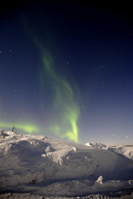
Displays such as this, seen over Iceland, can be pushed farther south due to solar flare eruptions. Since we already have a steady flow of particles striking our magnetic field, solar flares can be thought of as huge gusts of solar wind. With a higher amount of particles, smacking into the magnetic field, events known as geomagnetic storms can develop and cause Northern Lights displays to be seen in areas farther south than normal. In fact, with the recent X5 flare, auroras were reported as far south as Kansas, Illinois, and Wyoming just to name a few states.

While solar flares and solar storms can give us some beautiful sights in the skies, the more powerful ones can have detrimental effects here on the ground. The most common effects are more of the nuisance-variety. Radio signals can be disrupted or blocked entirely for the duration of the flare's impact on Earth. This may even spread to cellular activity, causing disruption of cell service or even blackouts. More pronounced and potentially hazardous effects include interference of GPS signals, entire power grids can be knocked offline, and in the most extreme and rare cases, it can even interfere with medical devices such as pacemakers. Often times, during an especially strong solar storm, air traffic is re-routed to avoid courses near the Poles. Since the bulk of solar particles and radiation collect in the atmosphere near Earth's Poles, airplane passengers could be exposed to small doses of radiation if a plane we to fly through these areas during the height of a solar storm. I want to emphasize however, that these impacts I mentioned are well-documented and planned for, so there is no reason to worry when you hear reports of an incoming solar flare. On average, it takes radiation from solar flares about 2 days to reach Earth, so we see them coming long before they get here. 

Wow, that was a lot! And the scary part is that we barely scratched the surface on this subject. I hope, though, that I was able to shed some light on the subject. The threat for large solar flares is diminishing for now, but we'll see what happens in the coming weeks and months! I'll leave you with some neat pictures from this latest burst of solar activity. Enjoy!


Northern Lights spotted over Alaska around the time of the X5 flare impact.


 A thin aurora spotted over Murmansk, Russia on a cloudless night.
Believe it or not, this is the Sun! A photographer in New Mexico was able to capture this with a standard camera. The dark spot on the upper-right side is the sunspot that caused the rash of X-flare during early March 2012. This could be seen with the naked eye!

Until next time!

Thursday, February 16, 2012

Winter 2012: What Winter? (Part 2)

Hi everyone, and welcome back!

Last week, we took a look at the winter that just hasn't been here in the Northeast. It probably comes as no surprise that a week later, well, nothing's changed. Sure we just had a brush with a weak winter storm, but it was just that...a brush. The fact of the matter is, winter has gone somewhere. It hasn't simply vanished from the face of the Earth. The problem is, winter has gone to areas that don't normally see it to the extent that they have this year. People of Alaska, Greenland, and especially Europe continue to try to dig out from, or just survive, winter's icy onslaught. The results, while record-breaking, have done far more harm than good.

In Alaska, residents are still reeling from one of the coldest January's on record. In fact, for most of northern Alaska it WAS the coldest January on record. In the town of Nome, the average air temperature for the entire month was -16.6°F. This shattered the previous record of -15.2°F back in 1989. The temperature also dropped to -40° in Nome for the first time since 1999. Statistics from other parts of Alaska are staggering as well! Here's a sampling:

January 2012
Alaska

Kotzebue       Average Temperature: -22.6°   Lowest Temperature: -45°
Galena          Average Temperature: -32.6°   Lowest Temperature: -65°
Bettles           Average Temperature: -35.6°   Lowest Temperature: -61°
Tanana          Average Temperature: -32.6°   Lowest Temperature: -61°

You get the idea. The coldest temperature recorded at any point was -66° in Fort Yukon, AK on January 31. Winter obviously in relentless full force in Alaska. But that's just one area. 

Greenland and Europe not only have the wicked cold, but snow has absolutely overwhelmed so many places. According to a "rule" followed by News10's own Steve Caporizzo (and the rest of us in the News10 weather department), when Greenland sees a winter with unrelenting snowstorms, we tend see fewer storms and consequently less snow here in New York and New England. The reason being that the jet stream tends to force the coastal storms that typically give us our whopper snowfalls farther out to sea before they have a chance to hit the Northeast. As a result, the storms arc into Greenland. We have seen this time and again this year, and the pattern simply refuses to change. 

For this particular winter though, Europe has seen the worst of it, especially when you consider the human toll.  A record-shattering cold outbreak in eastern Europe has claimed as many as 650 lives. Monster snowstorms have trapped tens of thousands of people in their homes as snow has piled up well over the roofs of houses and completely blocked off roadways. Local governments have had to resort to dropping supplies to trapped citizens by airlifts, and even those efforts have been extremely difficult due to nearly constant storms. Cars caught on local highways during the storms have found themselves in major pileups, and local authorities are unsure of when they will be able to clear the wreckage. This is just a small bit of the whole picture going on in Europe right now. For more details, check out the following link:


While only paying us brief visits here in the Northeast, winter has certainly been beating down on other parts of the globe. We may be missing it to a degree here, but let's hope that it lets up soon for those who have been suffering in it for weeks on end now. While this may only matter to those of us in the world of weather geeks, here's a bit of good news. Meteorological Spring begins in only 14 days on March 1. For so many, it cant' come soon enough.

Thanks for reading!

Until next time...

Thursday, February 9, 2012

Winter 2012: What Winter?

Hi everyone, and welcome back! Sorry for the long hiatus. The holiday season always gets busy in the weather office...and I'll admit, I may have gotten a little lazy with the blog. In any case, it's back to business, and it's time to talk about this winter that hasn't been.

As Fall 2011 drew toward its close, the inevitable wonder and worry about the upcoming winter began to force its way back into our minds. "How much snow will we get?" "How cold will it be" "How long will it last?" These are just some of the standard, basic questions of course, but ones we've all heard or asked time and again. So far, those answers may have gone like "not much," or "not very," or "It's Winter?!" That's not to say things won't change here in the Northeast, but it suffices to say that we are running out of time. (Personally, I'm just fine with this. Last year was more winter than I could ever care for.) Though interestingly enough, we find ourselves in the same climate pattern as we did a year ago: La Nina.

Here's a brief definition. La Ninoccurs when ocean temperatures in the east-central Pacific Ocean fall about 3°C - 5°C below normal. The common results are a prolonged period of wet weather in the Midwestern United States, drought in the Southeast, and milder, wetter summers in North America overall. These are typical, but not always guaranteed, as evidenced by the winter we're having so far.

When it comes to La Nina, Mother Nature sometimes keeps a wild card up her sleeve. This year, she's played it, and it's been working in our favor (or against us if you're a skier or snowboarder). This so-called wild card is what's known as the Arctic Oscillation (AO). Put simply, it is a large-scale climate pattern that has to do with atmospheric temperatures around the North Pole. The AO is classified as being in one of two phases: positive or negative. In a positive phase, which we have found ourselves in for nearly the entire winter,   temperatures tend to run warmer than normal across much of the eastern U.S. Couple that with La Nina which has forced the jet stream (storm track) farther north than usual, and you tend to get a winter where cold and snow are hard to come by. There are many other lesser factors that go in to all of this, but here's the main answer to why we have not had much of a winter this year. A second La Nina year in a row, combined with an ongoing positive phase in the AO is causing warmer than usual temperatures and is forcing storms farther away from our region or preventing them from forming in the first place. Amazing how you can have the same large-scale climate pattern in place, but get a completely different result thanks to a variation in some smaller variables. Let's compare some numbers:


Albany, NY
2010-2011 Snowfall:  87.2"
2011-2012 Snowfall:  13.6" (As of 2/9/2012)  <-- 24.8" below normal

By 2/9/2011, Albany had already received 60.7" of snow. The seasonal snowfall total of 87.2 made 2010-2011 the 14th snowiest winter on record. Records began in 1884.

Also, as of 2/9/2012, Albany has experienced an 18-day stretch of above-normal high temperatures.

Binghamton, NY
2010-2011 Snowfall:  117.5"
2011-2012 Snowfall:  27.1" (As of 2/9/2012)  <-- 25.2" below normal

By 2/9/2011, Binghamton had already received 69.2" of snow.

Syracuse, NY
2010-2011 Snowfall:  179.0"
2011-2012 Snowfall:  39.8" (As of 2/9/2012)  <-- 53.4" below normal

By 2/9/2011, Syracuse had already received 138.4" of snow.


What a difference a year makes, right? These are just a few examples from New York, but is a general theme across most of the northeastern U.S. This does not mean our current winter is a lost cause. After all, the weather can change in the blink of an eye. If you would like to look a little further into some of the other numbers around the country, check out local National Weather Service offices. You can find the NWS's main website here:

www.nws.noaa.gov

Thanks for reading!

Until next time...

Friday, September 2, 2011

A Look Back at Hurricane Irene, and Some things that Need to be Said...

Hi Everyone, and welcome back.

At this point, I think it's a good bet that the name "Irene" will be retired from the list of tropical storm/hurricane names. It certainly is a name that residents of the East Coast will not soon forget. It was a tropical system that affected literally everyone on the eastern seaboard in some manner. Heavy rain and strong winds struck the U.S. mainland from Florida to Maine, and reached as far inland as western Pennsylvania and New York.

Irene was a storm of "firsts." She was the first tropical system in the Atlantic in 2011 to reach hurricane strength, and she was also the first to become a major hurricane. She was also the first hurricane to impact the U.S. mainland in 4 years, and the first hurricane to make a direct strike on the Northeast in 20 years. The last to do so was Hurricane Bob in August, 1991.

What started as a tropical wave with potential off the African Coast on August 15, strengthened into a healthy tropical storm 5 days later in the central Atlantic. Two days later, after a brief landfall in Puerto Rico, Irene reached hurricane-strength and continued on toward Hispanola (Dominican Republic & Haiti). Her close brush with the island slowed her strengthening for just a bit, but Irene eventually emerged back over open water near the Bahamas and intensified to a Category 3, becoming the year's first major hurricane on August 23. She then spent Aug. 24 and 25 tearing through the Bahamas, leaving a trail of flooding and devastation across the island chain. By Friday August 26, she had her sights set on the U.S. and more specifically, North Carolina. Though her assault on the U.S. mainland began with intense rain bands over Florida, the brunt of Irene's power didn't truly come ashore until Saturday morning. Though Irene was a Category 3 storm through most of her trip near the Southeast, she weakened to a Category 1 storm before making landfall near Cape Lookout, North Carolina at 7:30 AM on Saturday August 27. Amazingly enough, Irene's strength did not deteriorate much, despite spending about 10 hours over land. Still a Category 1 storm, Irene next made landfall in New Jersey near Little Egg Inlet at 4:35 AM on August 28. By then, intense rain and winds from the system stretched from southern New Jersey almost to Lake George. She would make one final landfall at about 9:00 AM on Coney Island in Brooklyn as a tropical storm. Despite no longer being a hurricane, the devastation Irene would wreak up on New England and Upstate New York would be unfathomable. The storm continued on a northeastward track through New England, passing through the Berkshires and just west of Brattleboro, VT before lifting into Maine and ultimately out into Canada. Winds were strong here in our area, but the rain did incalculably more damage than anything the wind did. You've all been hearing the reports, so I won't go into specifics right now. We'll look at those a little farther down the road, when all of Irene's aftermath is said and done.

I do, however, have some points I want to make. In the day or two following Irene, I have seen and read many reports claiming that the forecasts for the storm were blown and that the storm was not as intense as expected. Some even claimed that the storm's track did not pan out as forecast. And it hasn't been just been anyone making these claims, its been meteorologists, news networks, an other respected figures in the field of weather. Frankly, I have to say that it is downright infuriating, not just as a meteorologist, but for the seeming disregard for individuals.

I may only be little over a year into my career as a meteorologist, but weather has been a part of my life for over 20 years. Yes, I still have lots to learn, but I can honestly say that I have never seen a hurricane forecasted so well; not only its path, but its intensity as well. I'll start with the storm's track. Yes, it did change several times. Early on, it looked like Florida was going to take a direct hit from the storm. Gradually the track forecast evolved and was adjusted and re-adjusted, just like any forecast would be when new data comes in. From the standpoint of the impact on the United States, you honestly could not have asked for a better forecast. From the time Irene was sitting just east of Florida, the forecasts brought her across North Carolina and then into New England. Minor adjustments east or west were made from time to time, sometimes bringing it closer to and then farther from areas like New York City. Even when the track did shift, it was only by about 20-30 miles, which is negligible when it comes to the track of the hurricane. At the risk of going on for hours, here's the bottom line: The track that Irene took along the entire East Coast from Florida to New England was correct to within 50 miles as much as 5 days in advance. It doesn't get much better than that. I will also say that I have never seen a tropical system's track forecasted as well as Irene's was.

On the subject of intensity, there's something that needs to be kept in mind. Hurricanes/tropical storms are not small, localized storms. They do vary in size, yes, but they are large, sprawling storms. When it comes to the intensity observed in a given location, it depends on where you are in relation to the storm's center. Based on the direction the storm is moving, you spilt it into 4 quadrants. If you wind up in the right 2 quadrants (particularly the right-front quadrant), the storm will tend to be more intense than in the left 2 quadrants. It has to do with momentum...I'll explain it in another post. Here's where I find things get extremely disappointing and frustrating when it comes to peoples' perception of how Irene's forecast panned out. I will just say it, I think a lot of it has to do with how New York City got by relatively unscathed when the forecasts were for more flooding and stronger winds. Irene did technically weaken to a tropical storm just before making landfall on Coney Island. When I say "just before" I mean literally about an hour before making landfall. The storm's center tracked just east of New York City, placing them in the "weaker" side of the storm. As a result, the winds were not as profound as they were in, say, Montauk or eastern Connecticut. The perception then seemed to be that the forecasters got it wrong, just because one location, admittedly a huge one, did not see as intense winds as were initially forecast. This led some in the meteorology field to go as far as to say that "this is why we can't trust the models all the time." That is such a dangerous thing to say...especially for one so widely known and popular as a "weatherman" as this person is. A statement like that will completely destroy peoples' faith in forecasts, and may lead people to not take warnings as seriously next time. And in this instance, it's a statement that is based on the impact in a single location, when literally thousands of locations on the East Coast were impacted. Here's the bottom line on this note: Hurricane Irene made landfall as a Category 1 storm in North Carolina as opposed to a Category 3 as was forecast 3 days in advance. The models DID catch this and adjust in advance though. As for the intensity forecast in New England, that was, to put a number on it, 95% correct. The forecast 3 days in advance was for the storm to be a Category 1 hurricane at landfall on Long Island with winds at 80 mph. She may have been a tropical storm at her New York landfall, but her winds were 65 MPH...a difference of only 15 MPH. That is also, about as close as you can get, plus it was that close as much as 3 days out.

The theme of the week on network news seems to be that "Irene was not as intense as forecasts thought." To anyone who honestly wants to think that, I will say this... Tell that to the people of Prattsville, NY whose town has literally been washed away by waters that came roaring down the Catskills. Tell that to the people of Middleburgh, NY and any other town along the Schoharie Creek whose towns were swallowed by water when the creek rose 20 feet due to Irene's "not-as-intense" rainfall. Tell that to the people of Wilmington and Brattleboro, VT who also had their towns inundated with water from the surrounding rivers, and had homes and businesses completely washed away. Tell that to anyone living along the Mohawk and Hudson Rivers who had their homes flooded when the waters rose. Tell that to people living in northern New Jersey, whose livelihoods have been swallowed by the Passaic River. Tell that to people who watched bridges and cars being swept away by raging rivers that were normally small, trickling creeks.

If the storm wasn't "as bad as expected" in a given area, instead of pointing fingers and saying the forecasts were wrong, how about we be thankful that it didn't turn out as badly? New York City Mayor Michael Bloomberg has been catching so much flak for evacuating parts of the city for what turned out "not to be as bad." The fact of the matter is, he made the right decision. He made a choice to do what he thought was best to protect the people of his city. People had to leave their homes or apartments for a day or two. So what? Shouldn't they be glad and relieved that they can go back to their home that isn't as badly damaged, if it even is at all? On the flip side, consider this. What if no evacuation order was given, and the storm had been worse than forecast? Bottom line: If you got by relatively unscathed, be thankful, instead of demonizing the forecasts. The forecasts are their for the benefit of the public, not the forecasters issuing them. It might not have been bad for you...but plenty of people lost absolutely everything.

As someone who was out in the storm on Sunday, I saw the devastation with my own eyes. I travelled from location to location around east-central New York. I saw towns swallowed by water, and people in absolute shock because they just lost their home. I saw streets turned into rivers of raging water, tossing trees like they were toothpicks and sweeping up cars like they were toys. I saw people being rescued from their flood-surrounded homes by bucket-loaders. And for as overwhelming as it got...I know I only saw an infinitesimally small piece of the whole picture.

To those who got by relatively unscathed, please don't lose sight of how lucky you are...because so many people lost everything. My thoughts and prayers go out to ALL who have been affected by this storm.

Thanks for reading, and listening...


Until next time...

Tuesday, July 19, 2011

H-O-T

Hello everyone, and welcome again! As if we needed any reminder, it's Summertime! Of course, with Summer we expect the heat and humidity levels to rise accordingly. Depending on where you live in the country...or the world, you've likely become accustomed to a certain level of Summer heat. Here in Upstate New York and New England, high 80s and low 90s generally serve as the threshold for what many residents would consider hot. Throw in a healthy dose of humidity, and things become uncomfortable fast. By contrast, head to parts of Texas, Arizona, New Mexico, and even the central Plains, and most people probably wouldn't bat an eyebrow at a day near 100°.

But, every now and again Mother Nature decides to crank the heater to the max and walk away for a while. It may start as something isolated, like a heat wave over southern Texas or the desert Southwest. A stretch of 95°+ degree days in Phoenix or Albuquerque or a few 100°+ days in Houston and Dallas. Initially, it may look like the pattern will break and the heat will die down. But then, seemingly overnight, the isolated pocket of blistering air becomes a surging torrid leviathan that envelopes two-thirds or more of the nation in dangerously hot and humid air. This has been exactly the case for the better part of the last 2 months here in the U.S.

Now, the monstrous mass of heat and humidity is beginning to make its move. A ridge of high pressure over the southern Plains is gaining strength and beginning its push toward the north and east. In most cases, a ridge of high pressure is something we'd celebrate to an extent. It means fair weather, and at other times of the year, a comfortable moderation in temperatures. This time, however, it's a torrent of dangerous heat that's set to cook us for days on end.

Here are some of the highlights from this unrelenting heat wave so far:

Excessive Heat Watches/Warnings and/or Heat Advisories have been posted for 30 states at the same time, with that number expected to rise to near 40.

As of 7/17/2011, Oklahoma City had seen 27 days with temperatures above 100°. That puts the city on pace to tie or break the record of 50 days set in 1980.

As of 7/10/2011, Witchita Fall, Texas had seen 36 or 38 days will temperatures above 95°.
Knoxville, Iowa recorded a heat index of 131° on 7/18/2011.

Minneapolis, Minnesota broke unofficial the record for the highest dew point temperature ever recorded there. The dew point reached 82 degrees between 3:00 and 4:00 PM on 7/19/2011, breaking the previous record of 81.

National high temperatures on 07/19/2011
All of that is just the tip of the iceberg (or inferno, I guess...) as far as records and notable statistics from this year's heat wave. Now that it's coming our way, it's important to be prepared, and to know what to do to keep yourself safe during an extreme heat wave. The fact of the matter is, heat is one of the biggest weather-related killers, and no one is immune to its dangers.

Here are some important heat safety tips, plus a breakdown of heat-related advisories and warnings:

Heat Advisory: High heat and humidity are expected to result in a heat index of 100°-105° during the daytime, or overnight lows above 80° are expected for 2 consecutive days or more.

Excessive Heat Watch: Issued by the National Weather Service when heat indices in excess of 105ºF during the day combined with nighttime low temperatures of 80ºF or higher are forecast to occur for two consecutive days.

Excessive Heat Warning: Issued when heat index values over 105° are expected for more than 3 hours per day for two days or more, or if heat index values over 115° are expected at all.

What you Should Do:
    -  Limit time spent outdoors.
    -  If you must conduct activities outdoors, limit them to either the early morning or evening.
    -  STAY HYDRATED! Drink plenty of cool water.
    -  Have a cool place to relax, preferably an air-conditioned one.
    -  Brings pets indoors and keep them out of the heat. Take them on short walks only.

Be safe over the next few days, everyone! Until next time!

Thursday, July 7, 2011

2011 Tornadoes: Another Revisiting

Welcome everyone! We all know that it has been an absolutely unforgiving and unrelenting year for tornadoes and extreme weather in general. One could spend weeks retelling and accounting it all, from the unprecedented onslaught of tornadoes in April, to the record floods along the Mississippi River and here in the Northeast in May, and back to tornadoes again in May and June. Extreme heat and drought have even made their presence known across a large expanse of the country in the Plains and parts of the Southwest. As promised though, one more time, we revisit the realm of powerful and deadly tornadoes.

The severe weather had seemed to be showing some mercy during the month of May. That of course came to a screeching halt on May 22, when an EF5 tornado tore through Joplin, Missouri killing over 150 people. But the tornadoes would not stop there that week. Just two days later, the same storm system would spark yet another outbreak of destructive twisters across the nation's heartland in Texas, Oklahoma, Kansas and Arkansas. Goldsby, Oklahoma would catch particular attention on the afternoon of May 24, 2011 as an EF3 tornado tore through parts of the town. Houses were wiped clean off of their foundations, leaving little more than a concrete slab behind. The twister itself was captured on video by KFOR's Chopper 4 as it tore across the countryside. The pilot even briefly set the chopper down near a demolished house to check on the survivors stepping out from their storm cellar. Despite the destruction seen across the town, no one was killed by this tornado.


Still, the picutres speak for themselves...


Above is an SRV (Storm Relative Velocity) radar image out of Norman, Oklahoma from the evening of May 24, 2011. The image shows wind speed and direction across the radar's field of view. Red colors note winds blowing away from the radar, while green colors denote winds that are blowing toward the radar. The circled area shows what is called a "couplet" and indicates an area where the winds within a storm are rotating and where a tornado may possibly be located. This particular image shows a strong tornado rolling through the western suburbs of Oklahoma City. Tornadoes are not usually this easy to spot on radar.

We here in the Northeast weren't spared from this year's tornado rampage. A strong cold front barreling across upstate New York and western New England brought the severe weather here to our neck of the woods, getting the month of June off to a destructive start. Shortly after noon on June 1, 2011 showers and strong thunderstorms began to develop in an unseasonably hot and humid air mass. Parts of Saratoga, Washington, and Rensselaer Counties in NY were bombarded with torrential downpours and enormous hail. The storms continued east into southern Vermont and western Massachusetts, dropping hail over 3" in diameter in some areas. The greater Albany area dodged a thunderstorm that just nicked the south side of the city, but this particular storm would make a name for itself before the day was over.

The cold front continued into central New England, taking the storms with it. However, on this day, central Massachusetts, southern Vermont, and southern New Hampshire was a simmering pressure cooker just waiting to pop. High heat and humidity coupled with favorable wind shear and a strong trigger along the cold front provided more than enough fuel to support strong, rotating thunderstorms. For as strong as the initial storms had been in eastern New York, they were only precursors to some absolutely explosive storms that would fire in central New England. By about 4:00 PM that afternoon, rotating supercell thunderstorms were exploding to life as they rolled downslope of the Bekshires. Severe thunderstorm and tornado warnings were alreay being issued, including one tornado warning that was issued around the Brattleboro/Keene area of VT and NH. Also around this time, the same cell that just missed Albany earlier in the day had now grown into a full-fledged supercell just to the west of Springfield, Massachusetts. The storm continued to strengthen as it began to bear down on the city. The greater Springfield area was placed under a tornado warning around 4:30 PM, and tower cameras in the city were about to catch video that would soon go viral in the coming hours. A powerful tornado swept in across the Connecticut River, plowing right into the city of Springfield. The twister damaged homes and businesses, destroyed countless vehicles, and even flipped a tractor trailer right in the middle of the evening rush hour. The tornado, later determined to be an EF3, was responsible for 3 deaths in the greater Springfield area.

Here is a shot taken from a tower camera in Springfield, MA as the tornado crossed the Connecticut River into the city.

One of many streets with demolished buildings following the tornado.

Another view of the tornado as it tore across the city of Springfield. The twister would continue as far east as Sturbridge, MA destroying several homes in the process.

It's been said time after time this year, but I'll say it one more time. All of these accounts of tornadoes serve as reminders of what an intensely active year it has been. Tornado activity has trailed off in recent weeks, and statistically we are beginning to head into the quieter time of the year. The year of extremes has survived in other ways, however. Record heat, more flooding in the northern Plains, and measurable snow over Colorado as late as the beginning of June keep giving up things to talk about, and keep weather in the news headlines. Now a month into hurricane season, we've had only one named storm in the Atlantic. Will this year of extremes expand its influence into a record year of hurricanes? Only time will tell.

Until next time!